
PHOENIX — As the ridge of high pressure builds over the region today and tomorrow, expect afternoon high temperatures to rise back into the triple digits.
Meantime, we have a disturbance slowly moving eastward and finally through the state Monday into Tuesday. As these disturbances slowly approach the region, expect wind of 15-20mph each afternoon, with the strongest breezes of 20-30mph on Monday.
A Fire Weather Watch has been issues for the portions of NE and SE Arizona Monday as strong wind mixes with very low humidity levels.


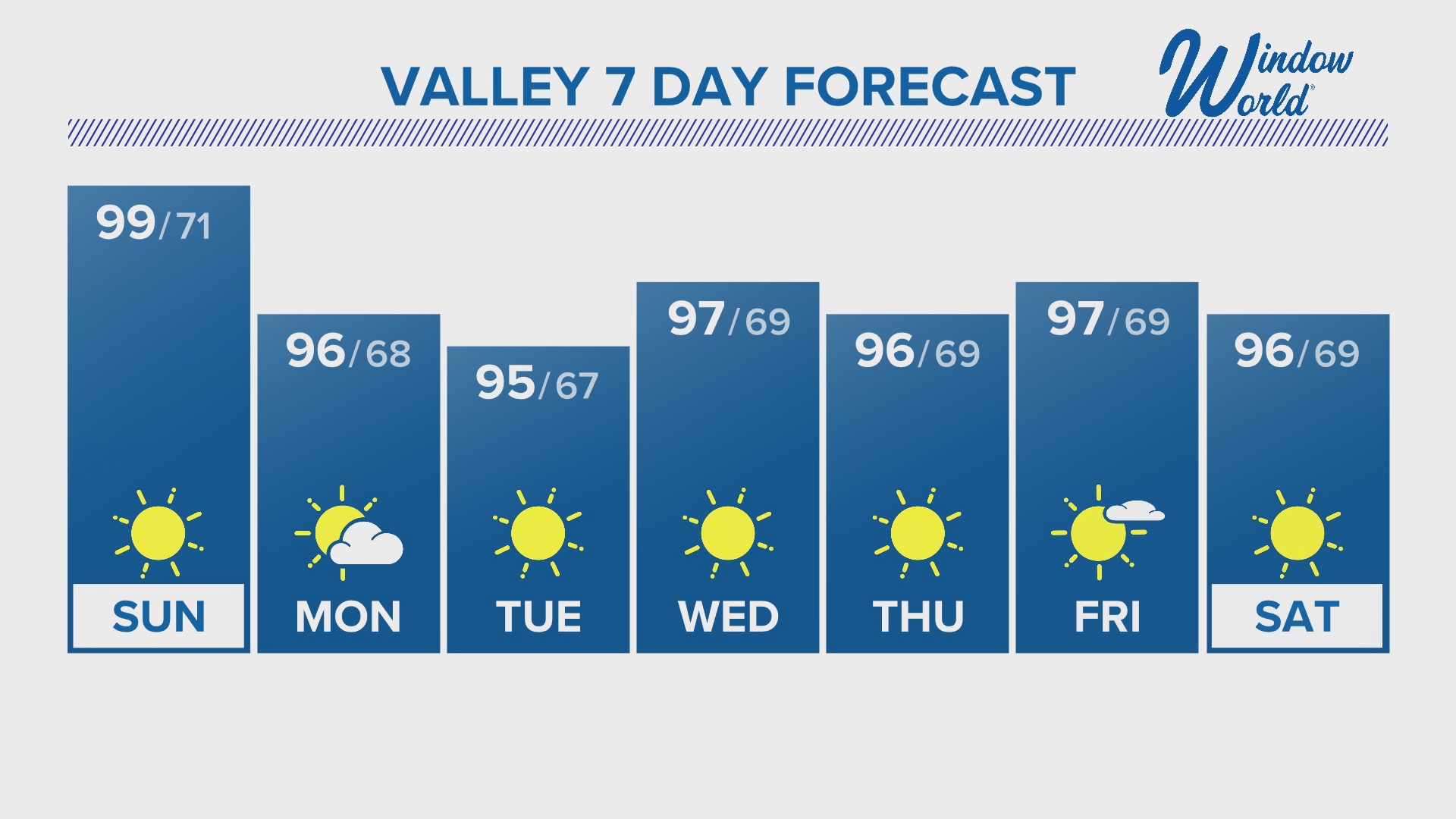
SUNDAY: 99/71 Sunny & breezy
MONDAY: 96/68 Clouds moving through
TUESDAY: 95/67 Mostly Sunny
WEDNESDAY: 97/69 Near normal
THURSDAY: 96/69 Clear Skies
FRIDAY: 97/69 Mostly sunny
SATURDAY: 96/69 Sunny & warm
Arizona Weather
Arizona has seen its fair share of severe weather throughout the state. Watch a compilation of videos from various thunderstorms, floods, and fires from across the Grand Canyon State on our 12News YouTube channel here.
Be sure to subscribe and see the latest in Arizona weather news and breaking weather emergencies throughout the Valley!
If you see storms, dust, beautiful sunsets, and more and you can safely do so, please share your photos and videos with us in the 12 News app, at pictures@12news.com, or on social media using the hashtag #BeOn12.
Download the 12 News KPNX app for Arizona weather updates:
iPhone: http://12ne.ws/iphone
Android: http://12ne.ws/android